EXUMA TIPS
Main Exuma Map

ExumaTips.com 8-Driving Locations You Need To See
Please see our maps below that show you how long it should take to Travel to each location and the distance in kilometers. These maps also appear on each one of there Tips pages.
Cocoplum Beach
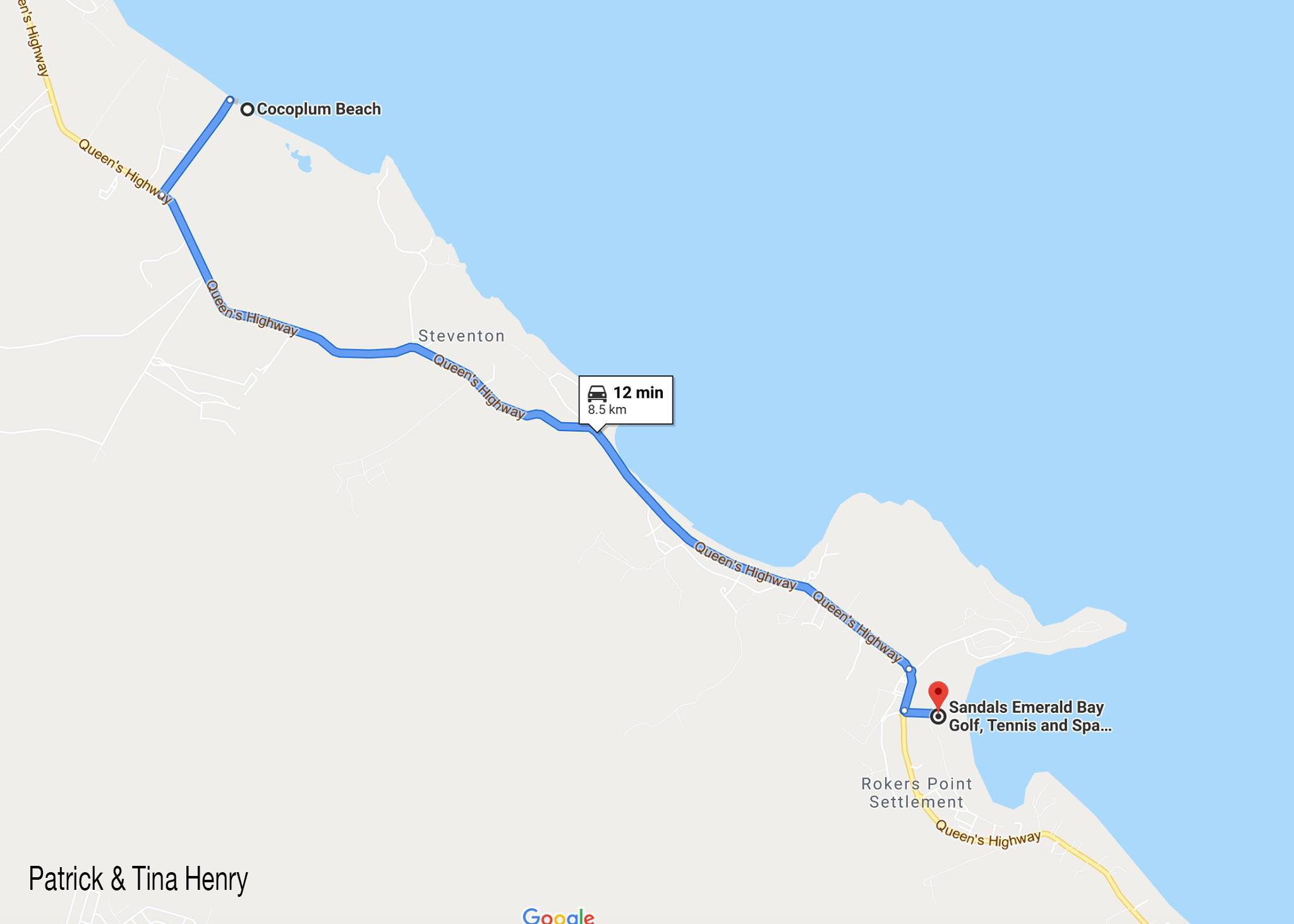
Drive North 5.25-miles (8.5km), Approximately A 12-Minutes Drive
Directions To Cocoplum Beach
Hoopers Bay

An 18-Minutes Drive From Emerald Bay. (10-miles / 16.2km)
Directions To Hoopers Bay
Georgetown, Bahamas
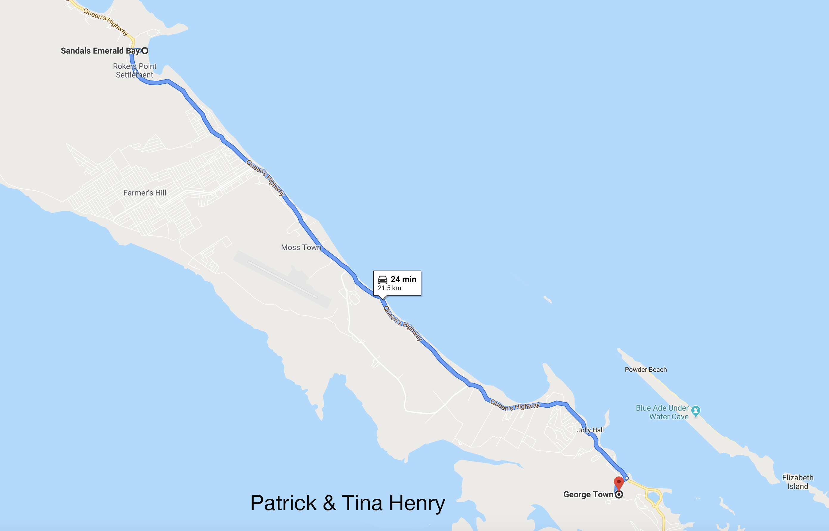
A 24-Minutes Drive13.35-Miles (21.5km) Drive From Emerald Bay
Directions To Georgetown, Bahamas
Chat ’N'Chill

A 25-Minutes, 13.78-miles (22.2km) Drive From Emerald Bay
Directions To Chat ’N’ Chill
Tropic Of Cancer
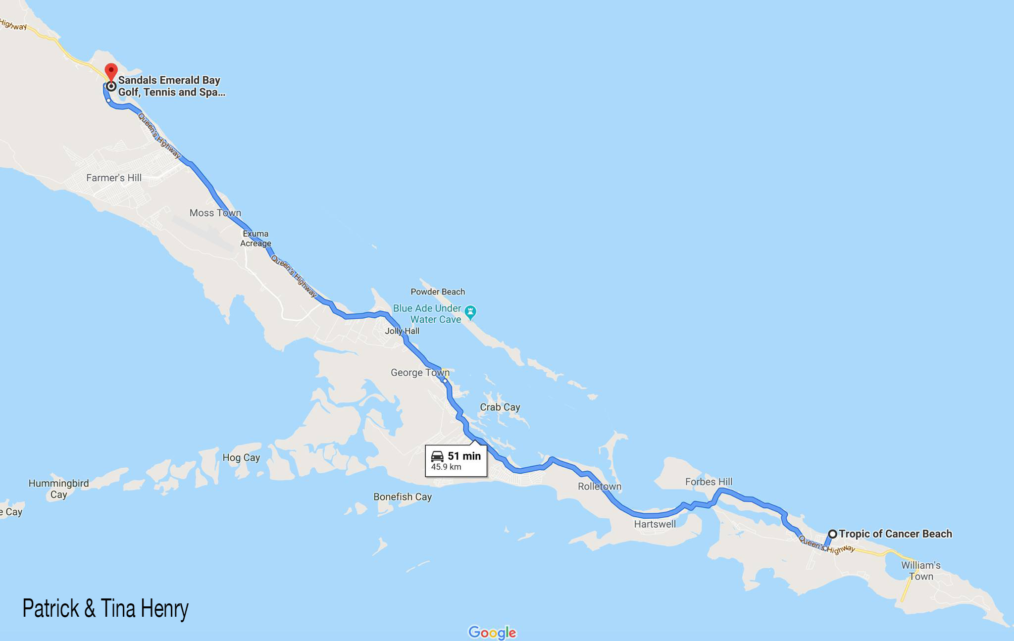
A 51-Minutes, 30.75-miles (45.9km) Drive From Emerald Bay
Directions To Tropic Of Cancer
The Salt Marker

A 55-Minutes Drive, 30-miles (50km) From Emerald Bay
Directions To The Salt Marker
Santanna’s Bar and Grill

A 51-Minutes Drive 30.7-miles (49.4km) From Emerald Bay
Directions To Santanna’s Bar and Grill
Bahama Mama's
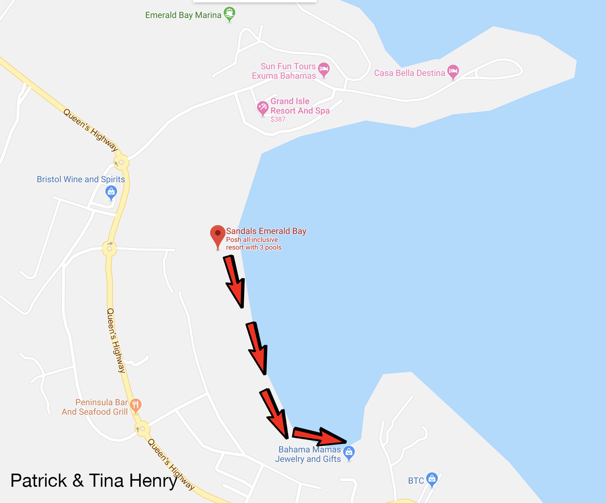
Walking Directions To Bahama Mama's
Directions To Bahama Mama
Exuma International Airport
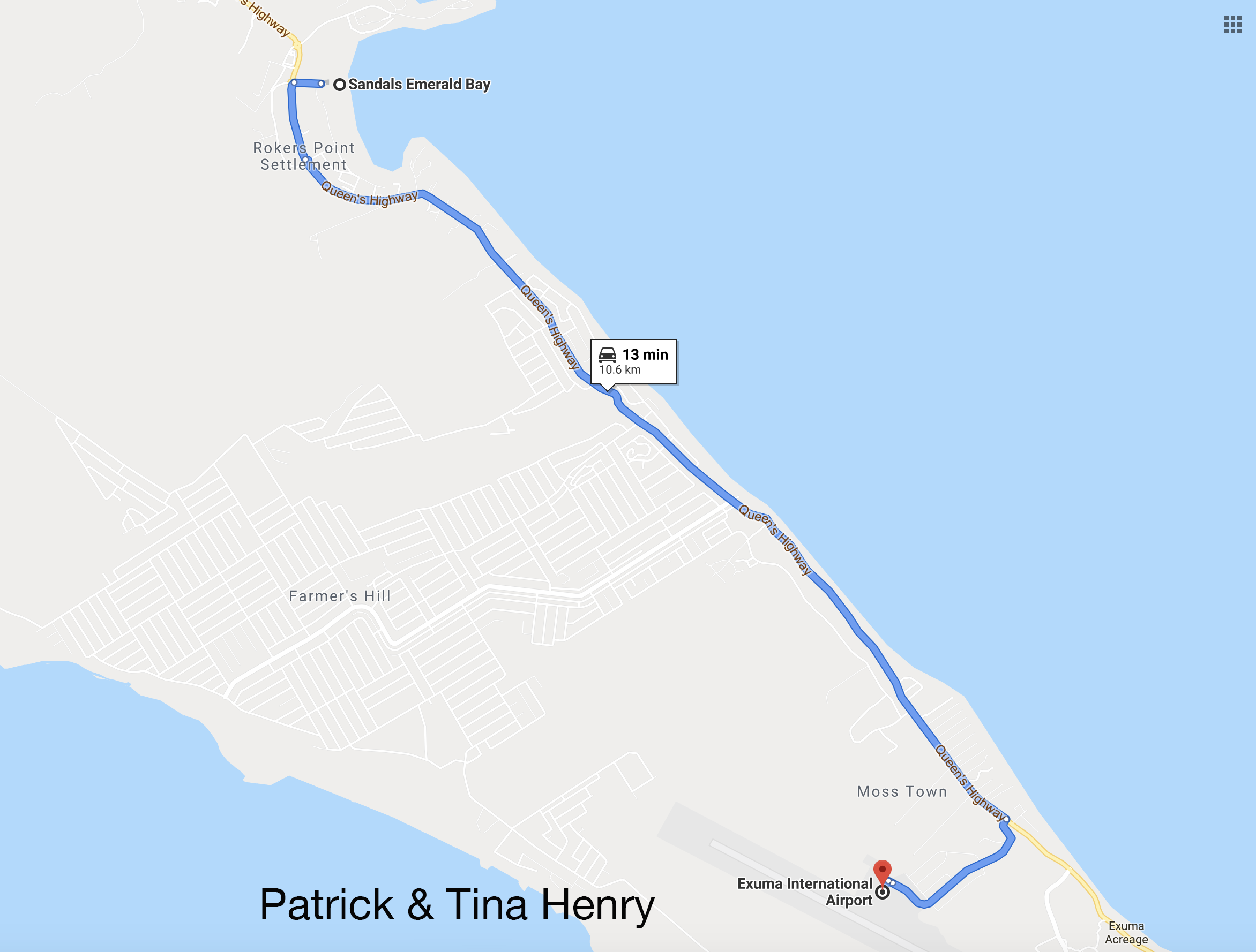
A Short 13-Minutes, 6.5-Miles (10.6km) Drive From Emerald Bay.
Directions To Exuma International Airport
Exuma Blues Escape

A 27-Minutes, 12.48-Miles (20.1km) Drive From Emerald Bay.
Directions To Exuma Blues Escape Located At
The Barraterre Post Office Docks